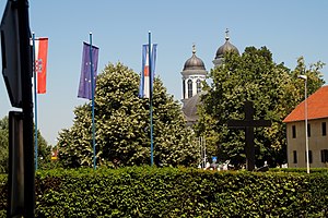
Suhopolje
Inpostasion de letura
| Suhopolje (hr) | |
|---|---|
| Pozision | |
| Stato | Croàsia |
| Rejon | Rejon de Virovitica e de ła Podravina |
| Popołasion | |
| Totałe | 5 267 (2021) |
| Densità | 31,61 hab./km² |
| Zeografia | |
| Àrea | 166,6 km²[1] |
| Còdazi de identifegasion | |
| Còdaze postałe | 33410 |
| Sito web | suhopolje.hr |
|
| |
Suhopolje el xe on comun inte la rejon de Virovitica e de ła Podravina che ła fa parte del stato de ła Croasia.
Evołusion demografica
[canbia | canbia el còdaxe]Altri projeti
[canbia | canbia el còdaxe]
 el detien schemi gràfeghi so
Łigadure foreste
[canbia | canbia el còdaxe]- ↑ 1,0 1,1 Declarà da: Register of spatial units of the State Geodetic Administration of the Republic of Croatia.
| Controło de autorità | VIAF (EN) 315939934 · WorldCat Identities (EN) 315939934 |
|---|

