Benalmádena
Appearance
Benalmádena | |
|---|---|
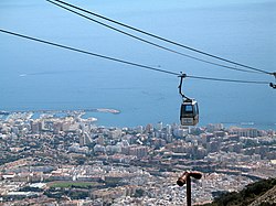
 Benalmádena Cable Car | |
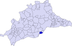
 Benalmádena shown within Málaga | |
| Coordinates: 36°36′N 4°31′W / 36.600°N 4.517°W | |
| Sovereign state | |
| Autonomous community | |
| Province | |
| Comarca | Costa del Sol Occidental |
| Administrative HQ | Benalmádena |
| Government | |
| • Type | Municipal corporation |
| • Body | Ayuntamiento de Benalmádena |
| • Mayor | Víctor Navas Perez (PSOE) |
| Area | |
| • Total | 27.2 km2 (10.5 sq mi) |
| Population (2018)[1] | |
| • Total | 67,746 |
| • Density | 2,500/km2 (6,500/sq mi) |
| Demonym | Benalmadenses |
| Time zone | UTC+1 (Central European Time) |
| • Summer (DST) | [[UTC+2 Benalmádena shown within Spain]] (Central European Summer Time) |
| Postal codes | 29630 29631 29639 |
| Dialling code | 95 |
| Website | www.benalmadena.es |
Benalmádena (Spanish pronunciation: [benalˈmaðena]) is a town in Andalusia in southern Spain, 12 km west of Málaga, on the Costa del Sol between Torremolinos and Fuengirola.[2][3][4]
References
[change | change source]- ↑ Municipal Register of Spain 2018. National Statistics Institute.
- ↑ "Comarcs". Disputación de Málaga. Archived from the original on 2012-10-17. Retrieved 28 May 2012.
- ↑ "Benalmádena". Mancomunidad de Municipios de la Costa del Sol Occidental. Archived from the original on 15 July 2004. Retrieved 28 May 2012.
- ↑ "Torremolinos, partido judicial nº12 de Málaga". Consejo General Procuradores de España. Archived from the original on 26 June 2003. Retrieved 28 May 2012.

