Ames, Iowa
Appearance
Ames, Iowa | |
|---|---|
 Clockwise from top: Main Street in downtown Ames, Iowa State University Alumni Hall, Marston Water Tower and Hoover Hall at ISU, Reiman Gardens, a train station in Ames, and Beardshear Hall | |
| Motto: "Smart Choice"[1] | |
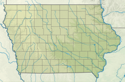
 Location in the State of Iowa | |
| Coordinates: 42°02′05″N 93°37′12″W / 42.03472°N 93.62000°W | |
| Country | |
| State | |
| County | Story |
| Incorporated | 1864 |
| Area | |
| • City | 27.92 sq mi (72.32 km2) |
| • Land | 27.58 sq mi (71.43 km2) |
| • Water | 0.34 sq mi (0.89 km2) |
| Elevation | 942 ft (287 m) |
| Population | |
| • City | 66,427 |
| • Rank | 9th in Iowa |
| • Density | 2,408.61/sq mi (929.96/km2) |
| • Urban | 66,342[3] |
| • Metro | 125,252 (Story and Boone counties) |
| Time zone | UTC−6 (CST) |
| • Summer (DST) | UTC−5 (CDT) |
| ZIP code(s)™ | 50010-50014 |
| FIPS code | 19-01855 |
| GNIS feature ID | 0454167 |
| Website | www |
Ames is a city in Iowa in the United States. In 2020 there were 66,427 people living in the city.[4] It is was built between Skunk River and Squaw Creek, 35 miles north of the state capital, Des Moines. The town was first settled in 1864 as a railway town at a spot where the Skunk River could be crossed easily.[5] It was named after Oakes Ames, a member of the US Congress who supported building the railway.[6]
Ames is the home of the Iowa State University. It is also famous for being the home of the United States Department of Agriculture's National Animal Disease Center.[6]
References
[change | change source]- ↑ "About Ames". City of Ames. Retrieved 5 April 2019.
- ↑ "2020 U.S. Gazetteer Files". United States Census Bureau. Retrieved March 16, 2022.
- ↑ "Urban and Rural: List of 2020 Census Urban Areas". United States Census Bureau. Retrieved July 22, 2023.
- ↑ 4.0 4.1 "Ames city, Iowa". United States Census Bureau. Retrieved November 3, 2023.
- ↑ "Ames, Iowa". Economic Expert. Retrieved 2009-11-14.[permanent dead link]
- ↑ 6.0 6.1 "Ames, Iowa Facts". CityTownInfo .com. Retrieved 2009-11-14.
Other websites
[change | change source]- The Ames Historical Society have many photos Archived 2009-12-10 at the Wayback Machine

