Zagarolo
Appearance
Zagarolo | |
|---|---|
| Comune di Zagarolo | |
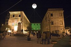
 Palazzo Rospigliosi | |
| Coordinates: 41°50′N 12°50′E / 41.833°N 12.833°E | |
| Kintra | Italy |
| Region | Lazio |
| Province | Roum |
| Frazioni | Valle Martella |
| Govrenment | |
| • Mayor | Giovanni Paniccia (centrosinistra) |
| Area | |
| • Total | 28 km2 (11 sq mi) |
| Elevation | 303 m (994 ft) |
| Population (2011)[1] | |
| • Total | 17,803 |
| • Density | 640/km2 (1,600/sq mi) |
| Demonym(s) | Zagarolesi |
| Time zone | UTC+1 (CET) |
| • Summer (DST) | UTC+2 (CEST) |
| Postal code | 00039 |
| Website | Offeecial wabsteid |
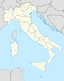
Zagarolo is a toun an comune in the province o Roum, in the region o Lazio o central Italy. It haes 17,803 inhabitants an a total aurie o 28 km2. Zagarolo lies 34 km. sooth-east o Roum an it borders the municipalities o Colonna, Gallicano nel Lazio, Monte Compatri, Palestrina, Roum, San Cesareo (umwhile frazione o Zagarolo). The historical toun centre o Zagarolo lees on a vera narrae tufaceous hill (2 kms. lang an aboot 100 meters wide) at a elevation of 310 meters, surroondit bi green valleys. The sooth continuation o the important pilgrim route Via Francigena passes throu the kintraside o Zagarolo.
Twin touns
[eedit | eedit soorce] Nelahozeves, Czech Republic
 Six-Fours-les-Plages, Fraunce
Notes
[eedit | eedit soorce]- ↑ "Istat official population estimates". Archived frae the original on 1 Julie 2011. Retrieved 1 Januar 2011.
Freemit airtins
[eedit | eedit soorce]- Offeecial wabsteid (in Italian)

