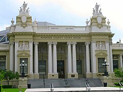
Hrabstwo Riverside
Wygląd
| hrabstwo | |||||

| |||||
| |||||
| Państwo | |||||
|---|---|---|---|---|---|
| Stan | |||||
| Siedziba | |||||
| Kod statystyczny |
FIPS 6-4: 06065 | ||||
| Powierzchnia |
18 915,02 km²[1] | ||||
| Populacja (2009) • liczba ludności |
| ||||
Położenie na mapie Kalifornia
| |||||
| 33°43′47,99″N 115°58′48,00″W/33,729997 -115,980000 | |||||
| Strona internetowa | |||||
Hrabstwo Riverside (ang. Riverside County) – hrabstwo w stanie Kalifornia w Stanach Zjednoczonych. Obszar całkowity hrabstwa obejmuje powierzchnię 7303,13 mil² (18 915,02 km²). Według szacunków United States Census Bureau w roku 2009 miało 2 125 440 mieszkańców[2].
Hrabstwo powstało w 1893 roku[3]. Na jego terenie znajdują się[4]:
- miejscowości – Banning, Beaumont, Blythe, Calimesa, Canyon Lake, Cathedral City, Coachella, Corona, Desert Hot Springs, Eastvale, Hemet, Indian Wells, Indio, Jurupa Valley, La Quinta, Lake Elsinore, Menifee, Moreno Valley, Murrieta, Norco, Palm Desert, Palm Springs, Perris, Rancho Mirage, Riverside (siedziba administracyjna hrabstwa), San Jacinto, Temecula, Wildomar.
- CDP – Aguanga, Anza, Bermuda Dunes, Cabazon, Cherry Valley, Coronita, Crestmore Heights, Desert Center, Desert Edge, Desert Palms, East Hemet, El Cerrito, El Sobrante, French Valley, Garnet, Glen Avon, Good Hope, Green Acres, Highgrove, Home Gardens, Homeland, Idyllwild-Pine Cove, Indio Hills, Lake Mathews, Lake Riverside, Lakeland Village, Lakeview, Mead Valley, Meadowbrook, Mecca, Mesa Verde, Mira Loma, Mountain Center, Nuevo, North Shore, Oasis, Pedley, Ripley, Romoland, Rubidoux, Sky Valley, Sunnyslope, Temescal Valley, Thermal, Thousand Palms, Valle Vista, Vista Santa Rosa, Warm Springs, Whitewater, Winchester, Woodcrest
Warunki naturalne
[edytuj | edytuj kod]- Na terenie hrabstwa znajduje się San Jacinto Peak, najwyższy punkt łańcucha San Jacinto Mountains (3304 m n.p.m.), wchodzącego w skład Gór Kaskadowych[5][6]. Oraz częściowo jezioro Salton Sea[7].
- Park Narodowy Joshua Tree (częściowo w hrabstwie San Bernardino)
Przypisy
[edytuj | edytuj kod]- ↑ US Census Bureau: California County. Population, Housing Units, Area, and Density: 2000. [dostęp 2011-01-23]. [zarchiwizowane z tego adresu (2015-01-08)]. (ang.).
- ↑ a b US Census Bureau: Riverside County. Quickfacts. [dostęp 2011-01-23]. (ang.).
- ↑ National Association of Counties: Riverside County, CA. [dostęp 2011-01-23]. (ang.).
- ↑ National Association of Counties: Places in Riverside County, CA. [dostęp 2011-01-23]. (ang.).
- ↑ San Jacinto Peak. SummitPost.org. [dostęp 2016-02-29]. (ang.).
- ↑ San Jacinto Peak, California. Peakbagger.com. [dostęp 2016-02-28]. (ang.).
- ↑ Victor M. Ponce: The Salton Sea: an assessment. San Diego State University. [dostęp 2019-08-17]. (ang.).


