Newtownabbey
Uiterlijk
| Plaats in Noord-Ierland | |||
|---|---|---|---|
| Situering | |||
| Graafschap | County Antrim | ||
| Coördinaten | 54° 39′ NB, 5° 54′ WL | ||
| Algemeen | |||
| Inwoners (2001) |
62.056 | ||
| Overig | |||
| Postcode | BT36, BT37 | ||
| Netnummer | 028 | ||
| Foto's | |||

| |||
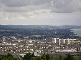
| Rathcoole | |||
| |||
Newtownabbey (Baile Úr na Mainistreach) is een plaats in het Noord-Ierse graafschap County Antrim. Het is een stedelijk gebied ten noorden van Belfast, en de grootste voorstad naast Lisburn. De plaats telt inclusief de kleinere plaatsen Carnmoney, Glengormley, Jordanstown, Monkstown, Rathcoole en Whiteabbey ongeveer 62.056 inwoners.
Geplaatst op:
24-06-2007
24-06-2007
Dit artikel is een beginnetje over landen & volken. U wordt uitgenodigd om op bewerken te klikken om uw kennis aan dit artikel toe te voegen.
