Toppers, Oklahoma
Appearance
Toppers | |
|---|---|
| Coordinates: 35°58′14″N 95°18′35″W / 35.97056°N 95.30972°W | |
| Country | |
| State | |
| County | Wagoner County |
| Area | |
| • Total | 3.31 sq mi (8.58 km2) |
| • Land | 2.32 sq mi (6.00 km2) |
| • Water | 0.99 sq mi (2.58 km2) |
| Elevation | 607 ft (185 m) |
| Population (2020) | |
| • Total | 911 |
| • Density | 393.35/sq mi (151.85/km2) |
| ZIP code | 74467 |
| GNIS feature ID | 1098948[2] |
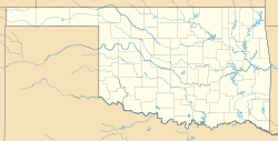
Toppers is an unincorporated community in Wagoner County, Oklahoma, United States, situated on Fort Gibson Lake.[3]
Demographics
[edit]| Census | Pop. | Note | %± |
|---|---|---|---|
| 2020 | 911 | — | |
| U.S. Decennial Census[4] | |||
References
[edit]- ^ "ArcGIS REST Services Directory". United States Census Bureau. Retrieved September 20, 2022.
- ^ "Toppers". Geographic Names Information System. United States Geological Survey, United States Department of the Interior. Retrieved February 11, 2011.
- ^ "Feature Detail Report". Geographic Names Information System. Retrieved May 6, 2008.
- ^ "Census of Population and Housing". Census.gov. Retrieved June 4, 2016.


