Jump to content

Robinson's Hole

Coordinates: 41°27′00″N 70°48′28″W / 41.4501089°N 70.8078094°W / 41.4501089; -70.8078094
From Wikipedia, the free encyclopedia
Robinson's Hole
Robinson's Hole is located in Massachusetts
Robinson's Hole
Robinson's Hole
Location of Robinson's Hole within Massachusetts
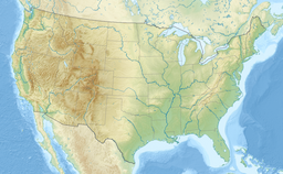
Robinson's Hole is located in the United States
Robinson's Hole
Robinson's Hole
Robinson's Hole (the United States)
Coordinates41°27′00″N 70°48′28″W / 41.4501089°N 70.8078094°W / 41.4501089; -70.8078094[1]
Part ofAtlantic Ocean

Robinson's Hole is the strait in Massachusetts' Elizabeth Islands separating Naushon Island from Pasque Island. It is one of four straits allowing maritime passage between Buzzards Bay and the Vineyard Sound. The others are Canapitsit Channel, Quick's Hole and Woods Hole. Robinson's Hole is located in the town of Gosnold.

References

[edit]
  1. ^ "Robinson's Hole". Geographic Names Information System. United States Geological Survey, United States Department of the Interior. Retrieved 2018-08-10.
pFad - Phonifier reborn

Pfad - The Proxy pFad of © 2024 Garber Painting. All rights reserved.

Note: This service is not intended for secure transactions such as banking, social media, email, or purchasing. Use at your own risk. We assume no liability whatsoever for broken pages.


Alternative Proxies:

Alternative Proxy

pFad Proxy

pFad v3 Proxy

pFad v4 Proxy