Le Champ-de-la-Pierre
Le Champ-de-la-Pierre | |
|---|---|
 | |
| Coordinates: 48°36′34″N 0°12′15″W / 48.6094°N 0.2042°W | |
| Country | France |
| Region | Normandy |
| Department | Orne |
| Arrondissement | Alençon |
| Canton | Magny-le-Désert |
| Intercommunality | Pays fertois et Bocage carrougien |
| Government | |
| • Mayor (2020–2026) | Jeanne-Marie Boudet[1] |
| Area 1 | 4.05 km2 (1.56 sq mi) |
| Population (2021)[2] | 30 |
| • Density | 7.4/km2 (19/sq mi) |
| Time zone | UTC+01:00 (CET) |
| • Summer (DST) | UTC+02:00 (CEST) |
| INSEE/Postal code | 61085 /61320 |
| Elevation | 238–315 m (781–1,033 ft) |
| 1 French Land Register data, which excludes lakes, ponds, glaciers > 1 km2 (0.386 sq mi or 247 acres) and river estuaries. | |
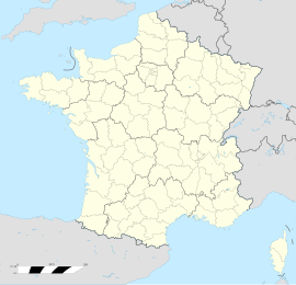
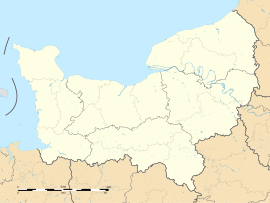
Le Champ-de-la-Pierre (French pronunciation: [lə ʃɑ̃ də la pjɛʁ] ) is a commune in the Orne department in north-western France.
Geography
[edit]The Commune is 410 hectares (1.6 sq mi) in size. The highest point in the commune is 271 metres (889 ft).
The commune is within the Normandie-Maine Regional Natural Park.[3]
Le Champ-de-la-Pierre along with another 70 communes is part of a 20,593 hectare, Natura 2000 conservation area, called the Haute vallée de l'Orne et affluents.[4]
Notable buildings and places
[edit]National heritage sites
[edit]The Commune has 2 buildings and areas listed as a Monument historique
Forge master's house is a ruin of a 17th-century building. It was classified as a monument in 1991.[6]
Stone Field Estate is a 14th-century chateau with extensive gardens, was classed as a Monument historique in 1993.[7] The gardens are a Pre-romantic park from the end of the 18th century open to the public, featuring a Maze.[8] The gardens are classified as a Jardins remarquables by the Ministry of Culture and the Comité des Parcs et Jardins de France.[9]
See also
[edit]References
[edit]- ^ "Répertoire national des élus: les maires". data.gouv.fr, Plateforme ouverte des données publiques françaises (in French). 2 December 2020.
- ^ "Populations légales 2021" (in French). The National Institute of Statistics and Economic Studies. 28 December 2023.
- ^ "rapport de charte" (PDF), parc-naturel-normandie-maine.fr/
- ^ "INPN - FSD Natura 2000 - FR2500099 - Haute vallée de l'Orne et affluents - Description".
- ^ "Le Champ-de-la-Pierre · 61320, France". Le Champ-de-la-Pierre · 61320, France.
- ^ "Grosse forge au Champ-de-la-Pierre - PA00110766". monumentum.fr.
- ^ "Domaine du Champ de la Pierre". POP : la plateforme ouverte du patrimoine (in French). Ministère de la Culture. 4 June 2023. Retrieved 4 June 2023.
- ^ "Historique". Le Champ-de-la-Pierre (in French). Le Champ-de-la-Pierre. 4 June 2023. Retrieved 4 June 2023.
- ^ "PARC ET JARDIN DU CHÂTEAU DU CHAMP DE LA PIERRE - Comité des Parcs et Jardins de France". www.parcsetjardins.fr.


