

Kursk Governorate
| Kursk Governorate Курская губерния | |||||||||
|---|---|---|---|---|---|---|---|---|---|
| Governorate of the Russian Empire (1796-1917), Russian Republic and RSFSR (1917–1928) | |||||||||
| 1796–1928 | |||||||||
 Coat of arms
| |||||||||
 Location in the Russian Empire | |||||||||
| Capital | Kursk | ||||||||
| Area | |||||||||
• 1914 | 46,455 km2 (17,936 sq mi) | ||||||||
• 1926 | 43,653 km2 (16,855 sq mi) | ||||||||
| Population | |||||||||
• 1914 | 3,256,600[1] | ||||||||
• 1926 | 2,906,360[2] | ||||||||
| History | |||||||||
• Established | 12 December 1796 | ||||||||
• Disestablished | 1928 | ||||||||
| |||||||||
| Today part of | Russia Ukraine | ||||||||
Kursk Governorate (Russian: Курская губерния, romanized: Kurskaya guberniya) was an administrative-territorial unit (guberniya) of the Russian Empire, which existed from 1796 to 1928 with its capital in Kursk.
Administrative divisions
[edit]As of 1914, Kursk Governorate included 15 uyezds.
- Belgorodsky Uyezd
- Grayvoronsky Uyezd
- Dmitriyevsky Uyezd
- Korochansky Uyezd
- Kursky Uyezd
- Lgovsky Uyezd
- Novooskolsky Uyezd
- Oboyansky Uyezd
- Putivlsky Uyezd
- Rylsky Uyezd
- Starooskolsky Uyezd
- Sudzhansky Uyezd
- Timsky Uyezd
- Fatezhsky Uyezd
- Shchigrovsky Uyezd
Symbolic
[edit]-
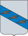 Coat of arms of the governorate before 1857
 -
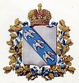 Coat of arms of the governorate (1880)


References
[edit]- ^ "1913_1". www.rus-sky.com. Retrieved 2024-02-17.
- ^ "Демоскоп Weekly - Приложение. Справочник статистических показателей". www.demoscope.ru. Retrieved 2024-02-17.
51°43′00″N 36°11′00″E / 51.7167°N 36.1833°E
This Russian history–related article is a stub. You can help Wikipedia by expanding it. |
This Russian location article is a stub. You can help Wikipedia by expanding it. |