

Duden Park
| Duden Park | |
|---|---|
 Duden Park | |
 | |
| Type | Public park |
| Location | Forest, Brussels-Capital Region, Belgium |
| Coordinates | 50°49′01″N 4°19′52″E / 50.81694°N 4.33111°E |
| Area | 24 ha (59 acres) |
Duden Park (French: Parc Duden; Dutch: Dudenpark) is a public park located in the municipality of Forest in Brussels, Belgium. It covers 24 hectares (59 acres) and has a level difference of 45 metres (148 ft), with its highest point being at an elevation of 90 metres (300 ft).[1]
Duden Park is home to the historical football club Royale Union Saint-Gilloise with Joseph Marien Stadium being located to the west of the park near the lowest point, at 55 metres (180 ft) elevation. The park is adjacent to Forest Park to its north.
-
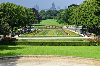 Duden Park
 -
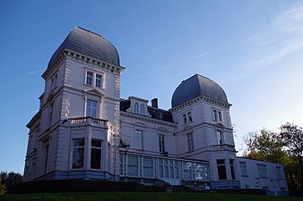 Duden Park château
 -
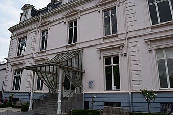 LUCA, School of Arts in the park's château


See also
[edit]References
[edit]Citations
[edit]- ^ "Parcs et Jardins de la Région Bruxelles Capitale". Archived from the original on 16 December 2004. Retrieved 23 April 2010.
Bibliography
[edit]- Demey, Thierry (2010). Bruxelles en vert. Le guide des jardins publics (in French). Brussels: Badeaux. ISBN 978-2-930609-00-3.
External links
[edit] Media related to Parc Duden at Wikimedia Commons