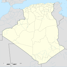
Djanet Inedbirene Airport
Appearance
Tiska Djanet Airport Djanet Inedbirene | |||||||||||||||
|---|---|---|---|---|---|---|---|---|---|---|---|---|---|---|---|
 | |||||||||||||||
| Summary | |||||||||||||||
| Airport type | Public | ||||||||||||||
| Operator | EGSA Alger | ||||||||||||||
| Serves | Djanet, Algeria | ||||||||||||||
| Elevation AMSL | 966 m / 3,169 ft | ||||||||||||||
| Coordinates | 24°17′34″N 9°27′8″E / 24.29278°N 9.45222°E | ||||||||||||||
| Map | |||||||||||||||
| Runways | |||||||||||||||
| |||||||||||||||
Tiska Djanet Airport (IATA: DJG, ICAO: DAAJ) is an airport serving Djanet, Algeria. The airport is in the desert 30 kilometres (19 mi) south of Djanet.[3] There is a VOR/DME and an NDB on the field for navigation.
The original Djanet Airport 24°26′54″N 9°30′21″E / 24.44833°N 9.50583°E is 12 kilometres (7.5 mi) south of Djanet, and is being repurposed as a storage yard.[4]
Airlines and destinations
[edit]| Airlines | Destinations |
|---|---|
| Air Algérie | Algiers, Illizi, Ouargla, Paris–Charles de Gaulle, Tamanrasset[5] |
| Tassili Airlines | Algiers, Illizi |
References
[edit]- ^ AIP and Chart from Service d'Information Aéronautique - Algerie (in French)
- ^ "DAAJ @ aerobaticsweb.org". Landings.com. Retrieved 2013-08-01.
- ^ "Google Maps". Google Maps. Retrieved 2018-02-01.
- ^ "Google Maps". Google Maps. Retrieved 2018-02-01.
- ^ "Air Algerie schedule". Archived from the original on 2007-10-11. Retrieved 2007-01-29.
External links
[edit]Wikimedia Commons has media related to Djanet Tiska Airport.
- Etablissement de Gestion de Services Aéroportuaires d’Alger (EGSA Alger)
- "DAAJ @ aerobaticsweb.org". Landings.com.
- Current weather for DAAJ at NOAA/NWS
