

Abbott Seamount
| Abbott Seamount | |
|---|---|
 | |
| Location | |
| Coordinates | 31°48′N 174°18′E / 31.800°N 174.300°E |
| Geology | |
| Last eruption | 36-40 million years ago |
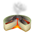
Abbott Seamount is a seamount lying within the Hawaiian-Emperor seamount chain in the northern Pacific Ocean. It erupted 36-40 million years ago.[1]
Position is 31° 48' 00" N, 174° 18' 00" E[2]
See also
[edit]References
[edit]- ^ Abbott Seamount - John Search
- ^ Abbott Seamount: Undersea Features. SOURCE: National Geospatial-Intelligence Agency, Bethesda, MD, USA
This article about a specific oceanic location or ocean current is a stub. You can help Wikipedia by expanding it. |