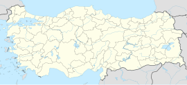
Armutlu, Bayburt
Appearance
Armutlu | |
|---|---|
| Coordinates: 40°29′04″N 40°21′48″E / 40.4844°N 40.3633°E | |
| Country | Turkey |
| Province | Bayburt |
| District | Bayburt |
| Population (2021) | 113 |
| Time zone | UTC+3 (TRT) |
Armutlu is a village in the Bayburt District, Bayburt Province, Turkey.[1] Its population is 113 (2021).[2]
History
[edit]Throughout history the village was known with its current name only with a slight difference as it was written as Armudlu.[3]
References
[edit]- ^ Köy, Turkey Civil Administration Departments Inventory. Retrieved 30 January 2023.
- ^ "Address-based population registration system (ADNKS) results dated 31 December 2021" (XLS) (in Turkish). TÜİK. Retrieved 30 January 2023.
- ^ Köylerimiz: 1 Mart 1968 gününe kadar (in Turkish). Ankara, Türkiye: İçişleri Bakanlığı İller İdaresi Genel Müdürlüğü. 1968. p. 169. Archived from the original on 23 February 2020.
{{cite book}}: CS1 maint: date and year (link)
