Marapa
Insel auf den Salomonen
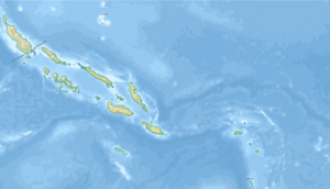
Marapa ist eine Insel im östlichsten Distrikt (ward) Birao der Provinz Guadalcanal, Salomonen, die rund drei Kilometer östlich der Insel Guadalcanal liegt und den Marau Sound im Osten begrenzt.
| Marapa | ||
|---|---|---|
| Gewässer | Salomonensee | |
| Inselgruppe | Salomon-Inseln | |
| Geographische Lage | 9° 49′ 0″ S, 160° 52′ 0″ O | |
|
| ||
| Länge | 5,5 km | |
| Breite | 3,4 km | |
| Fläche | 7,99 km² | |
| Höchste Erhebung | 106 m | |
| Hauptort | Awanararu | |
 | ||
