We are closely monitoring wildfires in states to the west of Colorado as the meteorological conditions are looking increasingly favorable (or unfavorable, depending on how you look at it) for smoke concentrations to increase across Colorado over the next 24-48 hours.
Let's start with wildfires in southern California. Up to this point this summer, southern California wildfires have not had much impact on our air quality here in Colorado. However, that may soon change.
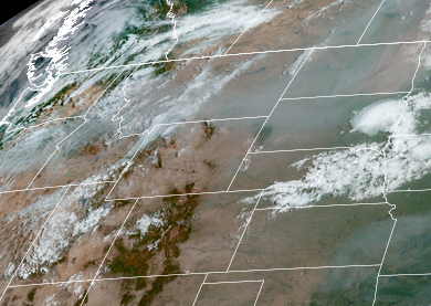
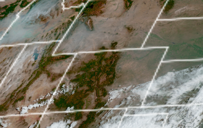
Satellite imagery from Tuesday, September 10th of large wildfires and heavy smoke in southern California.
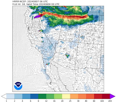
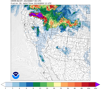
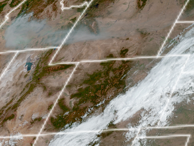
Smoke from these wildfires is already hanging over Nevada, Arizona and Utah. With southwesterly winds aloft, this smoke will likely be pushed over western Colorado by Wednesday evening. That smoke will likely stay up in the atmosphere Wednesday night and not cause any issues, but bigger changes are more likely to occur on Thursday. As the atmosphere heats up during the day on Thursday, some of that smoke will likely mix down to the surface across western Colorado. Meanwhile, a very strong upper level low pressure system is going to shift the upper level winds over the southern California wildfires from northwesterly to southwesterly which will transport additional smoke in the direction of Colorado.
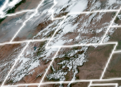
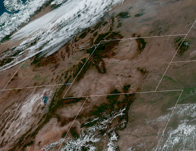
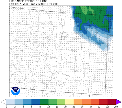
The GFS 600 millibar model late Thursday night shows the wind flowing from southern California into Colorado.
How much smoke will Colorado receive on Thursday? That is still unclear at this point. The good news is that it should be a pretty breezy day across much of the state which should limit smoke from accumulating too much at the surface of the earth, but we should anticipate hazy skies and at least some moderate concentrations of smoke (especially across the northern and western halves of Colorado).
Unfortunately, it is not only the southern California wildfires that may have an impact on our air quality. Long duration wildfires in Oregon and Idaho may also make their presence known by Thursday night. The good news is that smoke should impact a smaller section of Colorado, generally the northwestern part of the state. But that smoke could no doubt be noticeable by Friday morning in places like Craig, Rangely, and Meeker.
You can get more information on wildfires throughout the western US at InciWeb.
So we do advise Coloradoans throughout the state to keep checking this blog and remain up-to-date on the latest information as conditions continue to evolve. Although health advisories are not necessarily imminent, residents who are especially sensitive to wildfire smoke (asthma, COPD, etc.) should start making preparations now to limit exertion and outdoor activity starting Thursday and continuing into Friday. You can learn more about ways to protect your health at our wildfire smoke and health webpage.
Looking on the bright side, the storm system that will transport this smoke into Colorado will also bring a cooler and less dry air mass to the wildfire locations upwind. We are hopeful that air mass change will decrease the fire activity and smoke production, which in turn would decrease the threat of poor air quality in Colorado in the days and weeks ahead.


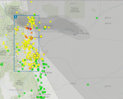
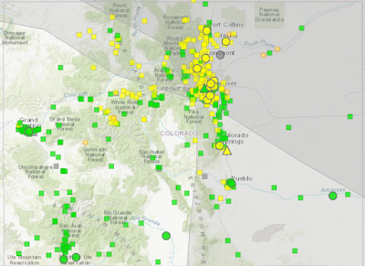
 from fire.airnow.gov shows good to moderate air quality around the state of Colorado on Friday morning.")


 September 7, 2024.")
 on Saturday, September 7th, 2024.")
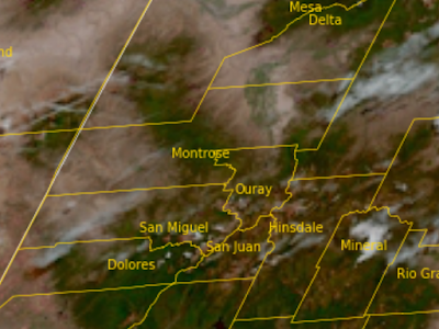
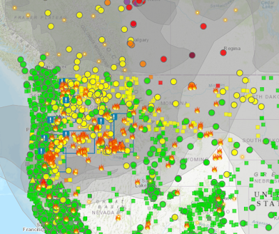
 in states surrounding Colorado.")


.")
.")