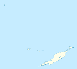
Sandy Hill, Anguilla
Appearance
Sandy Hill | |
|---|---|
District | |
| Coordinates: 18°13′20″N 63°00′48″W / 18.22218°N 63.01346°W | |
| Country | |
| Overseas Territory | Anguilla |
| Area | |
| • Land | 6.61 km2 (2.55 sq mi) |
| Population (2011)[1] | |
| • Total | 636 |
Sandy Hill is one of the fourteen Districts of Anguilla. Its population at the 2011 census was 636.[1]
Demographics
[edit]| Year | 1974 | 1984 | 1994 | 2001 | 2011 |
|---|---|---|---|---|---|
| Population | 314 | 376 | 364 | 557 | 636 [1] |
Politics
[edit]The incumbent is Jerome Roberts of the Anguilla Progressive Party.
References
[edit]- ^ a b c "Anguilla census data". Statoids.com. Retrieved 11 May 2021.

