Uploads by ChrisRuvolo
For ChrisRuvolo (talk · contributions · Move log · block log · uploads · Abuse filter log)
This special page shows all uploaded files that have not been deleted; for those see the upload log.
| Date | Name | Thumbnail | Size | Description |
|---|---|---|---|---|
| 18:13, 23 January 2015 | Newark NJ 1874.jpg (file) |  |
1.45 MB | High resolution from library of congress: http://tile.loc.gov/image-services/jp2.py?data=/service/gmd/gmd381/g3814/g3814n/pm005211.jp2&res=2 |
| 21:21, 21 September 2014 | UNDOF deployment September 2014.png (file) |  |
1.12 MB | {{Information |Description ={{en|1=UNDOF deployment. Map No. 2916 Rev. 85E; UNITED NATIONS; September 2014; (Colour)}} |Source =http://www.un.org/Depts/Cartographic/map/dpko/undof.pdf |Author =Department of Field Support Cartographic... |
| 18:56, 21 September 2014 | UNDOF deployment September 2014.svg (file) |  |
759 KB | User created page with UploadWizard |
| 04:00, 17 April 2014 | Amateur-radio-regions-with-600m-allocation.svg (file) |  |
1.56 MB | add french southern and antarctic territories |
| 00:47, 17 April 2014 | USS Growler-557-pano.jpg (file) |  |
2.26 MB | User created page with UploadWizard |
| 05:32, 14 February 2014 | IC-2100.jpg (file) |  |
985 KB | User created page with UploadWizard |
| 20:31, 27 March 2012 | Russia amateur callsign districts.svg (file) |  |
147 KB | == {{int:filedesc}} == {{Information |Description=Map of Russian Amateur Radio callsign districts |Source={{Derived from|Blank_map_of_Russia.svg|display=50}} |Date=2012-03-27 20:24 (UTC) |Author=*File:Blank_map_of_Russia.svg: User:Conscious *... |
| 21:38, 5 December 2011 | Japan callsign areas.svg (file) |  |
29 KB | move "JD1" up for better visibility when thumbnailed |
| 16:00, 31 October 2011 | ColumbiaHighSchoolMaplewoodNJ.jpg (file) |  |
3.24 MB | Reverted to version as of 16:35, 21 October 2011; back to high-res version |
| 03:21, 27 October 2011 | Port imperial road circuit.svg (file) |  |
2.82 MB | modify turns to better match published maps |
| 14:31, 16 August 2011 | VTALightRail.svg (file) |  |
89 KB | Snell and Cottle stations were swapped. corrected. |
| 15:28, 12 July 2011 | State Legislatures.svg (file) |  |
165 KB | remove background PNG |
| 20:07, 7 January 2011 | Montreal-tower-top.thumb2-crop.jpg (file) |  |
34 KB | {{Information |Description=The top of a tower supporting a yagi and several wire antennas. Snapshot by en:User:aarchiba. The flag is a en:Canadian flag. {{PD-user|aarchiba}} en:sr:Слика:Montreal-tower-top.thumb2.jpg |Source=*[[:File: |
| 22:06, 5 January 2011 | Amateur-radio-regions-with-4m-allocation.svg (file) |  |
1.56 MB | {{Information |Description={{en|1=Regions with an allocation in the Amateur Radio 4m band. Red regions have an official allocation. Blue regions have an experimental allocation.}} {{validSVG}} |Source=*File:BlankMap-World-Microstates.svg |Date=201 |
| 19:12, 5 January 2011 | Kenwood TS-830S.jpg (file) |  |
40 KB | crop |
| 03:24, 3 January 2011 | Kenwood-ts-430s-station.jpg (file) |  |
2.92 MB | {{Information |Description={{en|1=Kenwood TS-430S amateur radio HF transceiver, plus Kenwood AT-250 automatic antenna tuner.}} |Source={{own}} |Author=ChrisRuvolo |Date=2011-01-01 |Permission={{cc-by-sa-3.0}} |other_versions= }} [[Ca |
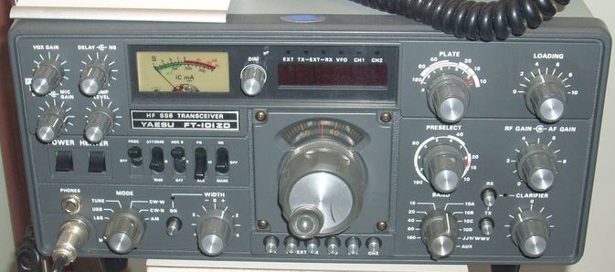
| 22:36, 5 November 2010 | Yaesu FT-101ZD.jpg (file) |  |
58 KB | crop |
| 16:49, 5 November 2010 | Kenwood TM-733A.jpg (file) |  |
151 KB | {{Information |Description={{en|1=Kenwood TM-733A FM 2m/70cm transceiver}} |Source=http://picasaweb.google.com/BrienDesrochersDurocher/Radioamateur#5305843886782532290 |Author=[http://picasaweb.google.com/BrienDesrochersDurocher BrienDesrochersDurocher on |
| 16:43, 5 November 2010 | Yaesu FT-817.jpg (file) |  |
158 KB | {{Information |Description={{en|1=Yaesu FT-817 portable QRP HF/VHF/UHF ham radio transceiver}} |Source=http://picasaweb.google.com/wildergeek/HamRadio#5447587276006810626 |Author=[http://picasaweb.google.com/wildergeek wildergeek on picasaweb] |Date=Jun 2 |
| 15:45, 5 November 2010 | Yaesu FT-901DM.jpg (file) |  |
1.45 MB | crop |
| 15:34, 5 November 2010 | Kenwood TS-590S.jpg (file) |  |
738 KB | crop |
| 15:29, 5 November 2010 | Icom IC-7600.jpg (file) |  |
688 KB | crop |
| 15:24, 5 November 2010 | ICOM IC-7800.jpg (file) |  |
384 KB | crop |
| 15:19, 5 November 2010 | Icom IC-7700 stone mountain hamfest.jpg (file) |  |
504 KB | crop |
| 15:15, 5 November 2010 | Icom IC-756PROIII.jpg (file) |  |
332 KB | crop |
| 15:10, 5 November 2010 | Icom IC-746PRO.jpg (file) |  |
281 KB | crop |
| 15:07, 5 November 2010 | ICOM IC-221.jpg (file) |  |
1.38 MB | crop |
| 14:10, 14 October 2010 | S-meter.jpg (file) |  |
12 KB | Reverted to version as of 14:17, 16 October 2005; -- less whitespace |
| 03:07, 5 September 2010 | UK amateur radio regional locators.svg (file) |  |
247 KB | Remove Z, that information is reportedly incorrect. Shetlands would be MM or GM, same as Scotland. |
| 18:08, 3 September 2010 | Xastir-screenshot.png (file) |  |
75 KB | {{Information |Description=Screenshot of the XASTIR software program, showing APRS data centered on New York City. APRS (Automatic Packet Reporting System) is a system built on amateur radio's packet radio system. The terminal window in the lower right |
| 14:41, 3 September 2010 | St Kilda mailboat.jpg (file) |  |
71 KB | increase contrast |
| 14:56, 2 September 2010 | US Amateur callsign regions.svg (file) |  |
110 KB | improve legibility a bit, fix spelling |
| 21:56, 30 August 2010 | ICOM IC-718.jpg (file) |  |
252 KB | crop to show only IC-718 |
| 17:54, 30 August 2010 | ICOM IC-7600.jpg (file) |  |
205 KB | {{Information |Description={{en|1=ICOM IC-7600 amateur radio transceiver}} |Source=http://picasaweb.google.com/sm0fob/SomeHamRadioActivity#5342440689000150978 |Author=[http://picasaweb.google.com/sm0fob Kjell, SM0FOB] |Date=May 30, 2009 |Permission= |othe |
| 15:46, 25 August 2010 | San Francisco earthquake and fire of 1906 - Genthe - LOC.png (file) |  |
4.8 MB | {{Information |Description={{en|1=* Title: San Francisco earthquake and fire of 1906 * Creator(s): Genthe, Arnold, 1869-1942, photographer * Date Created/Published: between 1906 and 1942; from a photograph taken 1906 Apr. * Medium: 1 slide : lantern ; 4 x |
| 22:32, 17 June 2010 | 2nd ave subway.svg (file) |  |
116 KB | show new orange M train service |
| 14:33, 8 June 2010 | Bergen County New Jersey Incorporated and Unincorporated areas Wyckoff Highlighted.svg (file) |  |
144 KB | |
| 22:25, 7 April 2010 | BSicon mSWKBHFer.svg (file) |  |
815 bytes | {{Information |Description=BS Rail icon |Source=based on File:BSicon muKBFad.svg |Date=~~~~~ |Author=~~~ |Permission={{PD-self}} |other_versions= }} Category:Icons for railway descriptions/mixed |
| 22:10, 7 April 2010 | BSicon mSWKBHFar.svg (file) |  |
817 bytes | {{Information |Description=BS Rail icon |Source=based on File:BSicon muKBFa.svg |Date=~~~~~ |Author=~~~ |Permission={{PD-self}} |other_versions= }} Category:Icons for railway descriptions/mixed |
| 17:40, 2 March 2009 | Lower Manhattan from Helicopter.jpg (file) |  |
497 KB | {{Information |Description={{en|1=Manhattan's Financial District, from a helicopter.}} |Source=http://flickr.com/photos/nosha/2272209685/ |Author=nosha on flickr |Date=posted to flickr on 2008-02-17 |Permission= |other_versions= }} <!--{{ImageUpload|full |
| 20:46, 5 September 2008 | New Jesery Mothballed (1948).jpg (file) |  |
106 KB | image is mirrored left/right. flipped with jpegtran (lossless). |
| 18:32, 14 July 2008 | 7 subway extension and hudson yards.svg (file) |  |
100 KB | add 7 line bullet |
| 13:22, 27 May 2008 | Bergen County, NJ municipalities labeled.svg (file) |  |
369 KB | reduce size of border lines |
| 22:39, 25 April 2008 | Bergen County New Jersey Incorporated and Unincorporated areas River Vale Highlighted.svg (file) |  |
144 KB | |
| 14:33, 13 December 2007 | BSicon WTUNNEL2+GRZq.svg (file) |  |
3 KB | == Summary == {{Information |Description='''English:''' Tunnel under water surface with border (for route diagram template) |Source=self-made (based on Image:BSicon WTUNNEL2.svg and [[:Image:BSicon eGRENZE leg |
| 14:32, 13 December 2007 | BSicon WTUNNEL1+GRZq.svg (file) |  |
3 KB | == Summary == {{Information |Description='''English:''' Tunnel under water surface with border (for route diagram template) |Source=self-made (based on Image:BSicon WTUNNEL1.svg and [[:Image:BSicon eGRENZE leg |
| 13:44, 15 November 2007 | Fort Jay and Manhattan Skyscrapers, Governor's Island NY.jpg (file) |  |
1.22 MB | {{Information |Description=Looking across Fort Jay on Governor's Island to Lower Manhattan's Skyscrapers |Source=self-made |Date=2007-07-08 |Author= ChrisRuvolo |Permission=GFDL/CC-BY-SA |other_versions= }} {{Location dec US|40.688888 |
| 15:02, 14 November 2007 | Castle Williams Governors Island NY.jpg (file) |  |
1.52 MB | {{Information |Description=Castle Williams on Governor's Island in New York Harbor |Source=self-made |Date=2007-07-08 |Author= ChrisRuvolo |Permission=GFDL/CC-BY-SA |other_versions= }} {{Location dec US|40.693187|-74.01864}} |
| 14:50, 14 November 2007 | NYC diamond district.jpg (file) |  |
1.42 MB | {{Information |Description=Photo of New York City's Diamond District at 5th Avenue and 47th Street |Source=self-made |Date=2007-03-13 |Author= ChrisRuvolo |Permission=GFDL/CC-BY-SA |other_versions= }} {{Location dec US|40.756681|-73. |
| 04:26, 27 August 2007 | West New York nj.png (file) |  |
23 KB | {{Information |Description=Map highlighting en:West New York, New Jersey within Hudson County |Source=based on Image:Secaucus nj.png |Date=2007-08-27 |Author=ChrisRuvolo (t) |Permission={{cc-by-sa-2 |