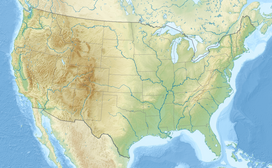
Mount Neva is a summit in Grand County, Colorado, in the United States.[4] With an elevation of 12,849 feet (3,916 m), Mount Neva is the 752nd-highest summit in the state of Colorado.[1]
| Mount Neva | |
|---|---|
 East aspect | |
| Highest point | |
| Elevation | 12,849 ft (3,916 m)[1] |
| Prominence | 506 ft (154 m)[1] |
| Parent peak | Mount Jasper (12,923 ft)[1] |
| Isolation | 0.88 mi (1.42 km)[1] |
| Coordinates | 40°00′25″N 105°41′18″W / 40.0069906°N 105.6883490°W[2] |
| Geography | |
| Country | United States |
| State | Colorado |
| County | Boulder County / Grand County |
| Protected area | Indian Peaks Wilderness |
| Parent range | Rocky Mountains Front Range[3] |
| Topo map | USGS Monarch Lake |
| Climbing | |
| Easiest route | Hiking class 2[1] |
Mount Neva was named for Chief Niwot's brother.[5]
Hiking
editMount Neva can be reached from the Fourth of July trailhead west of Nederland, Colorado. The trail is generally rather easy until it reaches Mount Neva's north ridge. Starting at this point, one follows the north ridge to the summit, but this requires long and sustained stretches of class 4 scrambling and climbing on terrain with very substantial vertical exposure.
Climate
editAccording to the Köppen climate classification system, the mountain is located in an alpine subarctic climate zone with cold, snowy winters, and cool to warm summers.[6] Due to its altitude, it receives precipitation all year, as snow in winter, and as thunderstorms in summer, with a dry period in late spring.
References
edit- ^ a b c d e f "Neva, Mount - 12,849' CO". listsofjohn.com. Retrieved April 19, 2023.
- ^ "Mount Neva". Geographic Names Information System. United States Geological Survey, United States Department of the Interior. Retrieved April 19, 2023.
- ^ "Mount Neva, Colorado". Peakbagger.com. Retrieved April 19, 2023.
- ^ U.S. Geological Survey Geographic Names Information System: Mount Neva (Colorado)
- ^ Dziezynski, James (1 August 2012). Best Summit Hikes in Colorado: An Opinionated Guide to 50+ Ascents of Classic and Little-Known Peaks from 8,144 to 14,433 Feet. Wilderness Press. p. 70. ISBN 978-0-89997-713-3.
- ^ Peel, M. C.; Finlayson, B. L.; McMahon, T. A. (2007). "Updated world map of the Köppen−Geiger climate classification". Hydrol. Earth Syst. Sci. 11. ISSN 1027-5606.

